Solutions
Digital Twins and Visualization
Digitale Zwillinge (engl. digital twins) sind virtuelle Repräsentationen der realen Welt. Durch sie können große Mengen an Daten benutzerfreundlich visualisiert und analysiert werden. Ob Bathymetrie-, Photogrammetrie-, oder Laserscandaten, unsere intelligente Softwarearchitektur unterstützt alle Arten von Messdaten für Ihren individuellen digitalen Zwilling. Wir konfigurieren unsere Applikationen so, dass diese in Ihrem Environment funktionieren. Diese Integration erfolgt unter Berücksichtigung höchster Standards, was Datensicherheit und Stabilität der Systeme betrifft. Mit den digitalen Zwillingen bietet Ocean Maps ein Komplettlösungssystem für Ihr Digitalisierungsprojekt.
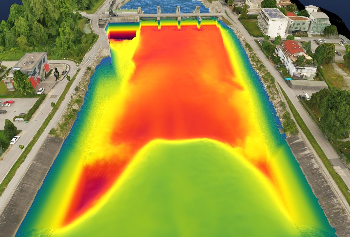
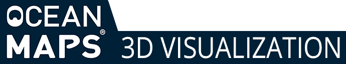
Bathymetry
Photogrammetry
Laserscan
further GIS data
Documentation
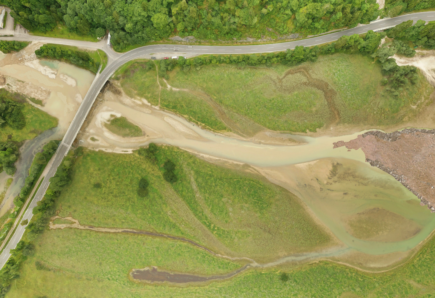
Digitale Zwillinge von Innenräumen erleichtern Planungs-, Bau- und Betriebsprozesse und bieten eine zuverlässige Informationsgrundlage für Entscheidungsfindungen. Während eines Bauprojekts helfen sie Probleme zu vermeiden und optimieren so Zeit- und Kostenersparnisse. Ist die Anlage in Betrieb, stellen sie eine entscheidende Grundlage für die Wartung und Instandhaltung dar. Unsere digitalen Zwillinge machen Pläne und komplexe Daten selbst für Laien besser verständlich und ermöglicht Nutzer:innen sich in einem Raum oder einer technischen Anlage besser zurechtzufinden.
Visualization and Analysis
Durch die 3D Visualisierung können Auffälligkeiten früh erkannt und dadurch Ausfallzeiten verhindert und kostspielige Wartungen vermieden werden. Die Analyse in unseren digitalen Zwillingen ermöglicht eine vereinfachte Ableitung von praktischen Erkenntnissen welche eine wichtige Grundlage für Entscheidungsfindungen darstellen.
Unlimited data integration
Our customers start with one digital twin and quickly experience the associated benefits. The proprietary architecture allows scaling up to over 1000 systems if required.
Support for all major platforms
iOS
ANDROID
We configure the measurement data and applications to suit your environment. Thus, we offer our applications for different platforms.
Windows
MAC OS
Data security at the highest level
You decide with whom you share your data. That's why Ocean Maps ensures that all customer data is protected particularly well. We repeat all the necessary efforts in a highly automated manner and in frequent intervals to ensure that the data is always up to date. Processing the survey data and generating the 3D representation is carried out exclusively by Ocean Maps. The integration of the data as well as the development and adaptation of the application are conducted in-house at our office in Salzburg.