Solutions
Bathymetric survey
Hat das letzte Hochwasser zur Unterspülung von Tragkonstruktionen einer Brücke geführt? Haben sich die in Speicherkraftwerken abgelagerten Sedimente signifikant verändert? Vermehrte Extremwetterereignisse erfordern schnelle und sichere Messmethoden. Ob mit Multibeam- Sonar oder ROV (Remotely Operated Vehicle), Ocean Maps bringt alles mit, was für eine effiziente und präzise Unterwasservermessung erforderlich ist. Unsere Sonare und ROVs können schnell zum Einsatz gebracht werden und bieten hochauflösende Unterwasseraufnahmen in Echtzeit. Der Einsatz unserer modernen Messgeräte ermöglicht problemlos genaue Inspektionen selbst in großer Tiefe, bei schlechten Sicht- und Strömungsbedingungen und in für Berufstaucher:innen gefährlichen Bereichen.
Selbst wenn Unwetter ausbleiben, müssen verletzliche Strukturen wie Brücken, Tosbecken oder Einlaufrechen regelmäßig überprüft werden. Ocean Maps schließt mit seinen Kunden Wartungsverträge ab, die Service- und Kostensicherheit bieten. Zu vereinbarten Intervallen senden wir ein Team mit der genau auf die spezifischen Anforderungen angepassten Ausrüstung.
Multibeam sonar
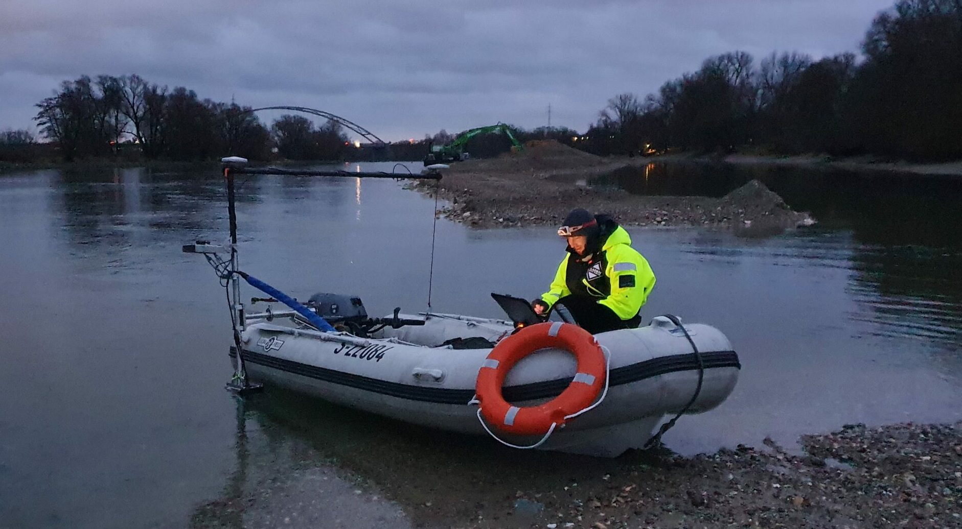
With our multibeam sonar (Sound Navigation and Ranging) system, we offer comprehensive and precise underwater surveys of navigable waters (lakes, rivers, shipping lanes, coastal areas, etc.). We acquire high-resolution, three-dimensional data for the inspection of hydraulic structures (ports, quays, power plants, etc.) and are your reliable partner when it comes to routine inspections of hydropower plants, port facilities and bridges.
Unser Sonarsystem kann an verschiedene Wasserfahrzeuge montiert werden. Die Installation des Multibeam Sonars an unseren patentierten ferngesteuerten KAT ermöglicht es uns selbst in sehr seichten Bereichen Daten zu erheben. Durch das geringe Gewicht unserer Schlauchboote können diese auch in schwierig zu erreichenden Gewässern, beispielsweise Bergseen, zum Einsatz kommen.
ROV
Durch den Einsatz unserer mit HD- Kameras ausgestatteten Unterwasserdrohnen oder ROVs können wir Bild- und Videoaufnahmen in Echtzeit übertragen. Die beweglichen Kameras ermöglichen eine schnelle und sichere Inspektion von Unterwasserbauwerken (Hafenbecken, Tosbecken, Spundwände, usw.) sowie die Erhebung von Informationen über die Gegebenheiten Unterwasser (Kolke, Sedimentakkumulation, Substrat, usw.). Die ROVs von Ocean Maps können schnell zum Einsatz gebracht werden und unerwünschte Veränderungen präzise aufspüren.